In Stock
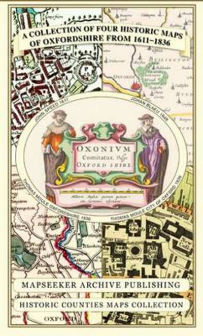
A Oxfordshire 1611 - 1836 - Fold Up Map that features a collection of Four Historic Maps, John Speed's County Map 1611, Johan Blaeu's County Map of 1648, Thomas Moules County Map of 1836 and a Plan of Oxford 1836 by Thomas Moule. The maps also feature a number of Oxfords famous historic buildings.
Sheet map, folded
€23.99
Collect 71 Reward Points
- Free Delivery from
- This Book Is Available Online Only
- Book Synopsis
- A Oxfordshire 1611 - 1836 - Fold Up Map that features a collection of Four Historic Maps, John Speed's County Map 1611, Johan Blaeu's County Map of 1648, Thomas Moules County Map of 1836 and a Plan of Oxford 1836 by Thomas Moule. The maps also feature a number of Oxfords famous historic buildings.
- Product Details
-
- ISBN
- 9781844918140
- Format
- Sheet map, folded
- Publisher
- Historical Images Ltd, (15 May 2013)
- Number of Pages
- 1
- Weight
- 104 grams
- Language
- English
- Dimensions
- 124 x 227 x 8 mm
- Series:
- See all books in this series
- Categories: