In Stock
Skye Pocket Map
Sheet map, folded
€5.80
Collect 17 Reward Points
- Reduced delivery schedule until 5th Jan
- Book Synopsis
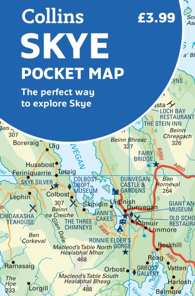
- Handy little full colour Collins map of Skye with a high level of detail. Clear mapping of the Isle of Skye showing the road network, ferries and places of interest. Map at a scale of 1:175 000 (3 miles to 1 inch).Clear, detailed, full colour Collins road mapping is presented in a handy format ideal for the pocket or handbag. It is excellent value and covers the whole of the Isle of Skye.This map includes:**x2022; Scotland route map**x2022; Caravan and camping sites**x2022; Tourist locations**x2022; Ferry links**x2022; Listing of major places to visit, with additional details for Dunvegan Castle, Old Man of Storr and Loch Coruisk**x2022; Detailed place names index.
- About The Author
- Explore the world through accurate and up-to-date mapping.
- Product Details
-
- ISBN
- 9780008492595
- Format
- Sheet map, folded
- Publisher
- Collins, (03 February 2022)
- Number of Pages
- 1
- Weight
- 40 grams
- Language
- English
- Dimensions
- 140 x 90 x 6 mm
- Categories: