-
BROWSE 1000s OF BOOKS IN STOCK
-
FREE DELIVERY ON ORDERS OVER €10
-
PRE-ORDER OBSESSED BY JOHNNY SEXTON
Renaissance Galway
Paperback
Series: See all books in this series
Categories:
Historical maps and atlases
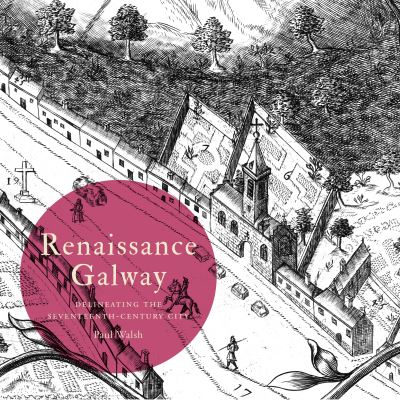
Renaissance Galway is the next ancillary publication from the Irish Historic Towns Atlas. The subject of the book is the remarkable 'pictorial map' of Galway, which was produced in the mid-seventeenth century. It offers a bird's eye view of Galway city at this time and presents insights into the cultural, sociopolitical and religious outlook of the local ruling elite - the so-called 'tribes' of Galway. Originally intended as a wall hanging, it was produced to impress and remains a centrepiece of Galway's visual history. Only two copies of the original printed map are known to exist and it is the well-preserved version from Trinity College, Dublin that is reproduced in Renaissance Galway. Following the format of previous map-guides from the Irish Historic Towns Atlas, the book presents carefully selected extracts from the pictorial map, each accompanied by a commentary. These range from descriptions of particular buildings or areas, to aspects of everyday life that are revealed in the map. In an introductory essay, the author ponders the many mysteries that continue to surround the pictorial map of Galway - its origins, compilers and purpose. Together the map extracts and accompanying texts offer a new perspective - a window into the culture and mindset of Galway's mid-seventeenth century ruling Catholic elite. The modern viewer is invited to inhabit the world of 'Renaissance Galway'. The Irish Historic Towns Atlas is a research project of the Royal Irish Academy and is part of a wider European scheme. www.ihta.ie
€13.50
Was €15.00

40 Reward Points
In stock online
Delivery in 1-2 working days
Delivery in 1-2 working days
Free Delivery on this item
Any purchases for more than €10 are eligible for free delivery anywhere in the UK or Ireland!
Renaissance Galway is the next ancillary publication from the Irish Historic Towns Atlas. The subject of the book is the remarkable 'pictorial map' of Galway, which was produced in the mid-seventeenth century. It offers a bird's eye view of Galway city at this time and presents insights into the cultural, sociopolitical and religious outlook of the local ruling elite - the so-called 'tribes' of Galway. Originally intended as a wall hanging, it was produced to impress and remains a centrepiece of Galway's visual history. Only two copies of the original printed map are known to exist and it is the well-preserved version from Trinity College, Dublin that is reproduced in Renaissance Galway. Following the format of previous map-guides from the Irish Historic Towns Atlas, the book presents carefully selected extracts from the pictorial map, each accompanied by a commentary. These range from descriptions of particular buildings or areas, to aspects of everyday life that are revealed in the map. In an introductory essay, the author ponders the many mysteries that continue to surround the pictorial map of Galway - its origins, compilers and purpose. Together the map extracts and accompanying texts offer a new perspective - a window into the culture and mindset of Galway's mid-seventeenth century ruling Catholic elite. The modern viewer is invited to inhabit the world of 'Renaissance Galway'. The Irish Historic Towns Atlas is a research project of the Royal Irish Academy and is part of a wider European scheme. www.ihta.ie
40 Reward Points
Any purchases for more than €10 are eligible for free delivery anywhere in the UK or Ireland!
€13.50
Was €15.00
40 Reward Points
Any purchases for more than €10 are eligible for free delivery anywhere in the UK or Ireland!
Series: See all books in this series
Categories:
Historical maps and atlases
Product Description
Renaissance Galway is the next ancillary publication from the Irish Historic Towns Atlas. The subject of the book is the remarkable 'pictorial map' of Galway, which was produced in the mid-seventeenth century. It offers a bird's eye view of Galway city at this time and presents insights into the cultural, sociopolitical and religious outlook of the local ruling elite - the so-called 'tribes' of Galway. Originally intended as a wall hanging, it was produced to impress and remains a centrepiece of Galway's visual history. Only two copies of the original printed map are known to exist and it is the well-preserved version from Trinity College, Dublin that is reproduced in Renaissance Galway. Following the format of previous map-guides from the Irish Historic Towns Atlas, the book presents carefully selected extracts from the pictorial map, each accompanied by a commentary. These range from descriptions of particular buildings or areas, to aspects of everyday life that are revealed in the map. In an introductory essay, the author ponders the many mysteries that continue to surround the pictorial map of Galway - its origins, compilers and purpose. Together the map extracts and accompanying texts offer a new perspective - a window into the culture and mindset of Galway's mid-seventeenth century ruling Catholic elite. The modern viewer is invited to inhabit the world of 'Renaissance Galway'. The Irish Historic Towns Atlas is a research project of the Royal Irish Academy and is part of a wider European scheme. www.ihta.ie
Product Details
ISBN9781911479079
FormatPaperback
PublisherROYAL IRISH ACADEMY (01 September. 2019)
No. of Pages100
Weight466
Language English
Dimensions 240 x 240 x 11