Fast & Free Shipping
Get FREE delivery in the Republic of Ireland when you spend €10 or more
In Stock
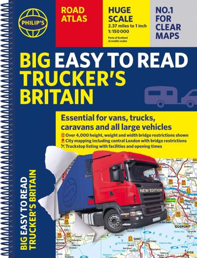
Philip's trucker's road atlas of Britain
Spiral bound
€21.59
Collect 64 Reward Points
- Free Delivery from
- This Book Is Available Online Only
- Book Synopsis
- PHILIP'S - THE ATLAS BRAND FOR TRUCKERS, CARAVANNERS AND OTHER SERIOUS ROAD USERS 'The best of its kind with quick and easy to use information' Fleet Week - Essential, large, easy-to-read mapping for Truckers (and for Caravanners, too) - Over 4,000 bridges with restrictions - either height, weight or width - located on the maps - Super-clear scale maps of the UK - 'the detail you need at a size you can read' - Special Feature: 'Bridge Strikes' (including 'Most Hit Bridges' - all bridges struck five or more times in a year) - Truck stop/large vehicle listings and location maps, including the facilities and opening times - All approach mapping/urban area maps with bridge restrictions - Large-print index - with 30,000 names - Big format and spiral binding - easy-to-use and easy-to-read on the road'Even though I have a satnav I find a map essential for planning in stops on long routes.' a trucker customerThe new Philip's Big Easy to Read Trucker's Road Atlas Britain shows over 4,000 bridges with restrictions - either height, weight or width - and is indispensable for anyone driving a large vehicle, caravan or lorry. Super-clear, large-print maps and packed with the most useful information for drivers of large vehicles.
- About The Author
- Philip's has been at the forefront of creating maps and atlases since 1834. Whether a local street map or a fact-packed World Atlas, we use the most up-to-date technology, expertise and our global network to ensure our customers have all the information they need.
- Product Details
-
- ISBN
- 9781849077248
- Format
- Spiral bound
- Publisher
- Philip's, (06 August 2025)
- Number of Pages
- 208
- Weight
- 1142 grams
- Language
- English
- Dimensions
- 388 x 294 x 16 mm
- Series:
- See all books in this series
- Categories: