-
BROWSE 1000s OF BOOKS IN STOCK
-
FREE DELIVERY ON ORDERS OVER €10
Road Atlas Ireland
Paperback
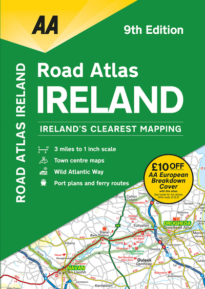
Includes AA approved camping sites, viewpoints, picnic sites, port plans and ferry routes. Toll motorways and motorway service areas are highlighted. Ten detailed city and town plans with street indexes of Belfast, Cork, Londonderry, Dublin, Galway, Killarney, Kilkenny, Limerick, Sligo and Waterford. An easy-to-read 3,500 place name index. Irish language areas shown on the main mapping with place names in English and Irish. District maps of Dublin and Belfast show the area in more detail. Fully updated in 3 miles to 1 inch format. Newly includes the Wild Atlantic Way route.
€9.27
Was €11.60

27 Reward Points
Currently out of stock
Delivery in 1-2 working days
Any purchases for more than €10 are eligible for free delivery anywhere in the UK or Ireland!
Includes AA approved camping sites, viewpoints, picnic sites, port plans and ferry routes. Toll motorways and motorway service areas are highlighted. Ten detailed city and town plans with street indexes of Belfast, Cork, Londonderry, Dublin, Galway, Killarney, Kilkenny, Limerick, Sligo and Waterford. An easy-to-read 3,500 place name index. Irish language areas shown on the main mapping with place names in English and Irish. District maps of Dublin and Belfast show the area in more detail. Fully updated in 3 miles to 1 inch format. Newly includes the Wild Atlantic Way route.
27 Reward Points
Any purchases for more than €10 are eligible for free delivery anywhere in the UK or Ireland!
€9.27
Was €11.60
27 Reward Points
Any purchases for more than €10 are eligible for free delivery anywhere in the UK or Ireland!
Product Description
Includes AA approved camping sites, viewpoints, picnic sites, port plans and ferry routes. Toll motorways and motorway service areas are highlighted. Ten detailed city and town plans with street indexes of Belfast, Cork, Londonderry, Dublin, Galway, Killarney, Kilkenny, Limerick, Sligo and Waterford. An easy-to-read 3,500 place name index. Irish language areas shown on the main mapping with place names in English and Irish. District maps of Dublin and Belfast show the area in more detail. Fully updated in 3 miles to 1 inch format. Newly includes the Wild Atlantic Way route.
Product Details
ISBN9780749582302
FormatPaperback
PublisherAA PUBLISHING (02 April. 2020)
No. of Pages104
Weight327
Language English
Dimensions 292 x 210 x 8