-
BROWSE 1000s OF BOOKS IN STOCK
-
FREE DELIVERY ON ORDERS OVER €10
John Muir Trail (topographic Map Guide)
SHEET MAP, FOLDED
Categories:
Travel maps and atlases
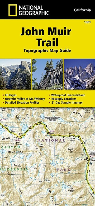
National Geographic's Map Guide of the John Muir Trail is an indispensable tool for navigating one of the most famous trails in the United States. The maps start at the northern terminus in Yosemite Valley and progress along the ridge of the Sierra Nevada, past Devils Postpile, and end at the highest point in the lower 48 on the top of Mount Whitney. Along the way you will pass through; Yosemite National Park, Ansel Adams Wilderness, Devils Postpile National Monument, John Muir Wilderness, Kings Canyon National Park, and finally, Sequoia National Park & Mt Whitney.
€21.74

65 Reward Points
In stock online
Extended Range: Delivery in 2-3 working days
Extended Range: Delivery in 2-3 working days
Free Delivery on this item
Any purchases for more than €10 are eligible for free delivery anywhere in the UK or Ireland!
National Geographic's Map Guide of the John Muir Trail is an indispensable tool for navigating one of the most famous trails in the United States. The maps start at the northern terminus in Yosemite Valley and progress along the ridge of the Sierra Nevada, past Devils Postpile, and end at the highest point in the lower 48 on the top of Mount Whitney. Along the way you will pass through; Yosemite National Park, Ansel Adams Wilderness, Devils Postpile National Monument, John Muir Wilderness, Kings Canyon National Park, and finally, Sequoia National Park & Mt Whitney.
65 Reward Points
Any purchases for more than €10 are eligible for free delivery anywhere in the UK or Ireland!
€21.74
65 Reward Points
Any purchases for more than €10 are eligible for free delivery anywhere in the UK or Ireland!
Categories:
Travel maps and atlases
Product Description
National Geographic's Map Guide of the John Muir Trail is an indispensable tool for navigating one of the most famous trails in the United States. The maps start at the northern terminus in Yosemite Valley and progress along the ridge of the Sierra Nevada, past Devils Postpile, and end at the highest point in the lower 48 on the top of Mount Whitney. Along the way you will pass through; Yosemite National Park, Ansel Adams Wilderness, Devils Postpile National Monument, John Muir Wilderness, Kings Canyon National Park, and finally, Sequoia National Park & Mt Whitney.
Product Details
ISBN9781566956895
FormatSHEET MAP, FOLDED
PublisherNATIONAL GEOGRAPHIC (26 September. 2014)
No. of Pages1
Weight94
Language English
Dimensions 235 x 216 x 7