-
BROWSE 1000s OF BOOKS IN STOCK
-
FREE DELIVERY ON ORDERS OVER €10
East Anglia A-Z Road Atlas
PAPERBACK
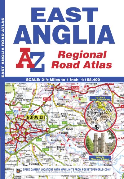
A full colour regional road atlas of East Anglia featuring 39 pages of continuous road mapping that covers an area extending to: Grantham, Sleaford, Boston, King's Lynn, Cromer, Great Yarmouth, Felixstowe, Clacton-on-Sea, Colchester, Chelmsford, Harlow, Hemel Hempstead, Leighton Buzzard and Stamford.Mapping is shown at a clear 2.5 miles to 1 inch scale (1.58 km to 1 cm) and includes the following features: Motorways open with full junction detail, motorways under construction and proposed, service areas, primary routes and destinations, A & B roads, selected minor roads, gradients 1:5 and steeper, tolls, mileages, county boundaries, spot heights and hill shading Selected safety camera locations with their maximum speed limits Selected fuel stations National Park boundaries Selected places of interest, tourist information centres and golf coursesAlso included are 14 city, town, airport or port plans for: Bedford, Bury St. Edmunds, Cambridge, Chelmsford, Colchester, Ely, Great Yarmouth, Ipswich, King's Lynn, Norwich, Luton, Peterborough, Harwich Port and London Stansted Airport.The index section lists cities, towns, villages, hamlets and locations covered by this atlas.
€11.59

34 Reward Points
In stock online
Extended Range: Delivery in 2-3 working days
Extended Range: Delivery in 2-3 working days
Free Delivery on this item
Any purchases for more than €10 are eligible for free delivery anywhere in the UK or Ireland!
A full colour regional road atlas of East Anglia featuring 39 pages of continuous road mapping that covers an area extending to: Grantham, Sleaford, Boston, King's Lynn, Cromer, Great Yarmouth, Felixstowe, Clacton-on-Sea, Colchester, Chelmsford, Harlow, Hemel Hempstead, Leighton Buzzard and Stamford.Mapping is shown at a clear 2.5 miles to 1 inch scale (1.58 km to 1 cm) and includes the following features: Motorways open with full junction detail, motorways under construction and proposed, service areas, primary routes and destinations, A & B roads, selected minor roads, gradients 1:5 and steeper, tolls, mileages, county boundaries, spot heights and hill shading Selected safety camera locations with their maximum speed limits Selected fuel stations National Park boundaries Selected places of interest, tourist information centres and golf coursesAlso included are 14 city, town, airport or port plans for: Bedford, Bury St. Edmunds, Cambridge, Chelmsford, Colchester, Ely, Great Yarmouth, Ipswich, King's Lynn, Norwich, Luton, Peterborough, Harwich Port and London Stansted Airport.The index section lists cities, towns, villages, hamlets and locations covered by this atlas.
34 Reward Points
Any purchases for more than €10 are eligible for free delivery anywhere in the UK or Ireland!
€11.59
34 Reward Points
Any purchases for more than €10 are eligible for free delivery anywhere in the UK or Ireland!
Product Description
A full colour regional road atlas of East Anglia featuring 39 pages of continuous road mapping that covers an area extending to: Grantham, Sleaford, Boston, King's Lynn, Cromer, Great Yarmouth, Felixstowe, Clacton-on-Sea, Colchester, Chelmsford, Harlow, Hemel Hempstead, Leighton Buzzard and Stamford.Mapping is shown at a clear 2.5 miles to 1 inch scale (1.58 km to 1 cm) and includes the following features: Motorways open with full junction detail, motorways under construction and proposed, service areas, primary routes and destinations, A & B roads, selected minor roads, gradients 1:5 and steeper, tolls, mileages, county boundaries, spot heights and hill shading Selected safety camera locations with their maximum speed limits Selected fuel stations National Park boundaries Selected places of interest, tourist information centres and golf coursesAlso included are 14 city, town, airport or port plans for: Bedford, Bury St. Edmunds, Cambridge, Chelmsford, Colchester, Ely, Great Yarmouth, Ipswich, King's Lynn, Norwich, Luton, Peterborough, Harwich Port and London Stansted Airport.The index section lists cities, towns, villages, hamlets and locations covered by this atlas.
Product Details
ISBN9781843487951
FormatPAPERBACK
PublisherGEOGRAPHERS' A-Z MAP CO LTD (29 November. 2018)
No. of Pages60
Weight120
Language English
Dimensions 245 x 170 x 5